GLENROCK WEST Voting District, Converse County, Wyoming
About
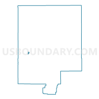
Outline

Summary
| Unique Area Identifier | 698566 |
| Name | GLENROCK WEST Voting District |
| County | Converse County |
| State | Wyoming |
| Area (square miles) | 0.97 |
| Land Area (square miles) | 0.97 |
| Water Area (square miles) | 0.00 |
| % of Land Area | 100.00 |
| % of Water Area | 0.00 |
| Latitude of the Internal Point | 42.85919450 |
| Longtitude of the Internal Point | -105.87423930 |
Maps


Graphs
Select a template below for downloading or customizing gragh for GLENROCK WEST Voting District, Converse County, Wyoming